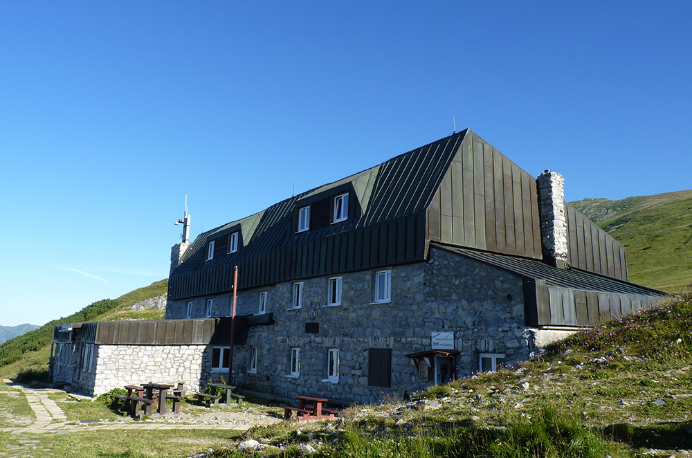
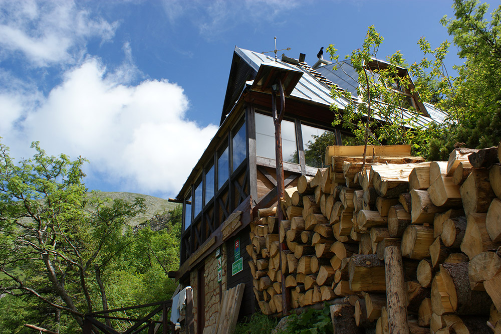
General Milan Rastislav Štefánik’s Cottage (1,740m above sea level) is a high-mountain cottage offering year-round services. It is located in a saddle under the Ďumbier peak on the main Low Tatras ridge. It was built in the years 1924-1928 and it is the longest operating high-mountain cottage in the Low Tatras mountains. It is the final destination of mountain hikes, the start of climbs to the highest peaks of the mountains (Ďumbier, Chopok, Dereše), it offers shelter – food and accommodation during hikes of the Low Tatras ridge. It is also popular with ski mountaineers who come there because of the ideal conditions near the cottage. Close to the cottage, there is the Cave of Dead Bats, the only high-altitude cave in Slovakia, open to the public.
Activities - Hiking

Mountain guide
Mountain guide Uhlár John, who is a member UIMLA-Union of International Mountain Leaders Associations, offer expeditions for Low and High Tatras in summer and winter.
Prices of this service is individual according to the number of persons and the chosen route. For more information call the telephone number +421 948 026839
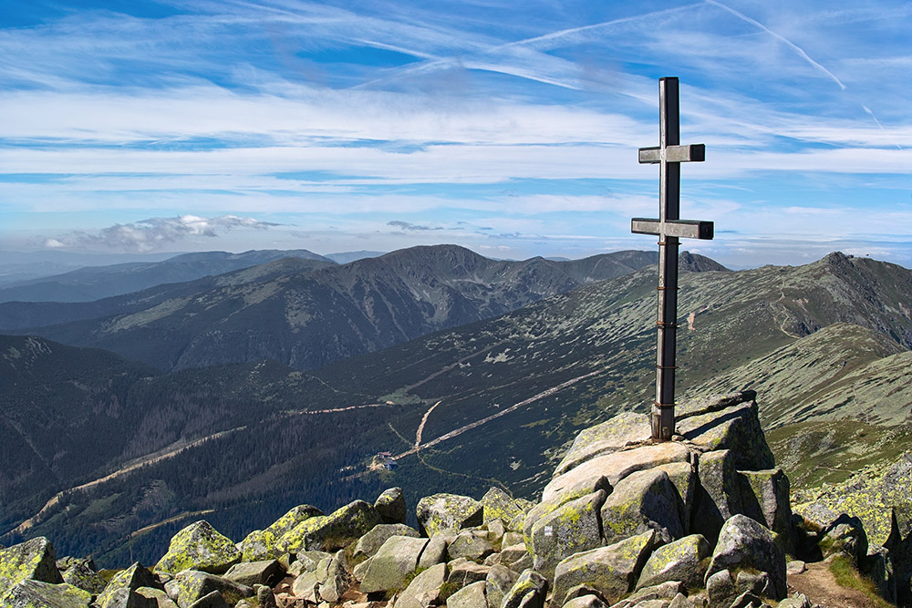
Ďumbier
Ďumbier (2046m) is the highest peak of the Low Tatras mountains. It is situated on the main ridge in the eastern part of the Ďumbier Low Tatras above Jánska and Ludárová valleys in the north and Trangoška and Srdiečko in the south. Štefánik’s Cottage is nearby.
If you are looking for a short, easy hiking trail, you can reach Ďumbier from Trangoška through Štefánik’s Cottage. The climbing route to the top is built without any technical safety aids. Thanks to its ideal location, easy access and well-developed hiking trails, the top is quite easy to access for all age groups. You can either choose to start from the Štefánik’s Cottage, Trangoška, Chopok or the Demänovská valley. If you decide to set off from Trangoška, you can park your car on the paid central car park.
Milan Rastislav Štefánik’s Cottage
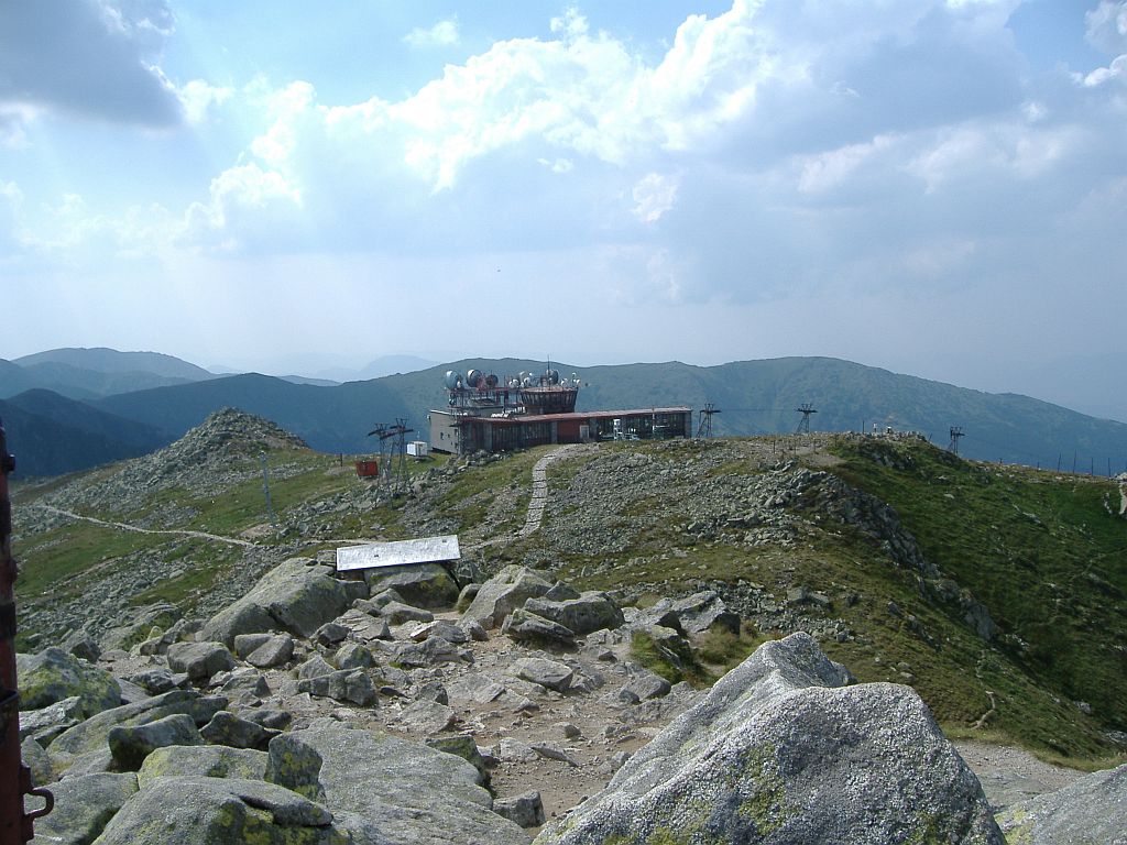
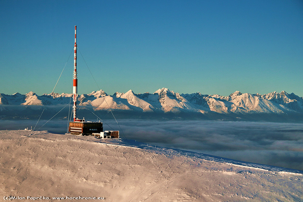
Chopok
With its 2024m, Chopok is the third highest peak of the Low Tatras. It is located on the main ridge within the geomorphological unit of the Ďumbier Tatras between the Dereše and Ďumbier peaks. Near the top, there is the Cottage under Chopok, a cabin car station connecting the northern and southern side of Chopok, and a meteorological station. Chopok is one of the windiest places in Slovakia. The slopes of Chopok are a popular place for winter and summer hiking: the southern and northern sides of Chopok were connected in December 2012. Visitors are transported via the most modern cabin cars and ski drag lifts in Slovakia.
Kráľova Hoľa
Kráľova hoľa is at an altitude of 1946m above sea level. It is located on the border of Eastern and Central Slovakia and it is the highest peak of the eastern Low Tatras mountains. Springs of important Slovak rivers including the Čierny Váh, Hron, Hnilec, and Hornád rivers are located in the Kráľova hoľa area. Every suggested hiking trail to Kráľova hoľa includes an elevation over 1000m above sea level and they are rated as medium difficult.
Undoubtedly, Kráľova hoľa is one of the most scenic and most popular hiking destinations in Slovakia. It offers a unique view of Spiš, the High Tatras, Liptov, as well as the Horehronie regions. This huge, lighthouse-like hill, punctuated by a high transmitting antenna, keeps the wind and clouds away from its magnificent surroundings. It can be reached by several hiking trails from the villages of Šumiac, Telgárt or Liptovská Teplička, from where the hiking trail is the longest. It is up to you which trail you choose.
The Kráľová hoľa peak is a starting point for ridge walks towards Čertovica, where you can sleep over at the Andrejcová tourist log cabin shelter, which serves as an emergency accommodation for tourists.
Jaskyňa mŕtvych netopierov (Dead bats cave)
The Cave of Dead Bats is located in the middle of Slovakia in the central part of the Low Tatras ridge within the Ďumbier high-mountain carst (1750m above sea level). The relatively tiny, deeply wrinkled limestone massive block called Kozie chrbty is 2 kilometres long and 300 meters wide, contains in its bowels a number of passages in 14 floors and two parallel branches discovered so far. The biggest underground space called Bystrický dóm is located on the 7th floor at a depth of 180 meters directly under M. R. Štefánik’s Cottage and its volume is 52,500 cubic meters.
You can reach the cave from the southern side from the village of Bystrá by car or by bus from Brezno or Podbrezová to Trangoška or Srdiečko. The trail from Trangoška to the Cottage under Ďumbier takes approximately 1 hour (1740m above sea level). Another trail starts from Srdiečko. You can take a lift to the transit station Kosodrevina or to the peak station Chopok and start your trail to M. R. Štefánik’s Cottage under Ďumbier from there. You have several trail options from Liptov as well. You can either walk from Liptovský Ján or take a lift from Jasná to Chopok and hike from there to the mountain cottage.
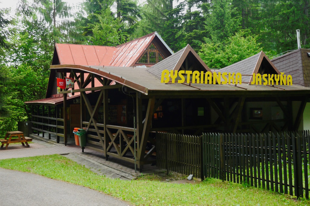
Bystrianska cave
The cave is located in the submersion zone of the Bystriansko-valaštiansky carst in the Bystrianske foothills of the Horehronie valley on the southern side of the village Bystrá near the Tále recreational area on the southern side of the Low Tatras. The cave entrance is on the foothill of the north-western slope of Chodorov Hill at an altitude of 565 meters. It is the most significant cave of the Horehronie valley. It is known for its remarkable rock formations and the formation of underground spaces, occurrence of sinter decorations as well as favourable climatic conditions for speleotherapeutic treatment.
The cave was formed due to tectonic erosion and modified by an underground river currently flowing through the cave at a depth of 15 to 20 meters under the level of the sightseeing route. You can see three, approximately 20-meter deep abysses during the tour. The cave is interesting due to the variety of spaces that can be seen on the sightseeing route.
The sightseeing route is 580 meters long and there is almost no elevation (only 26 steps). The cave is also wheelchair accessible. The tour takes 45 minutes. The temperature in the cave ranges from 5.7 to 6.7°C (42 to 44°F).
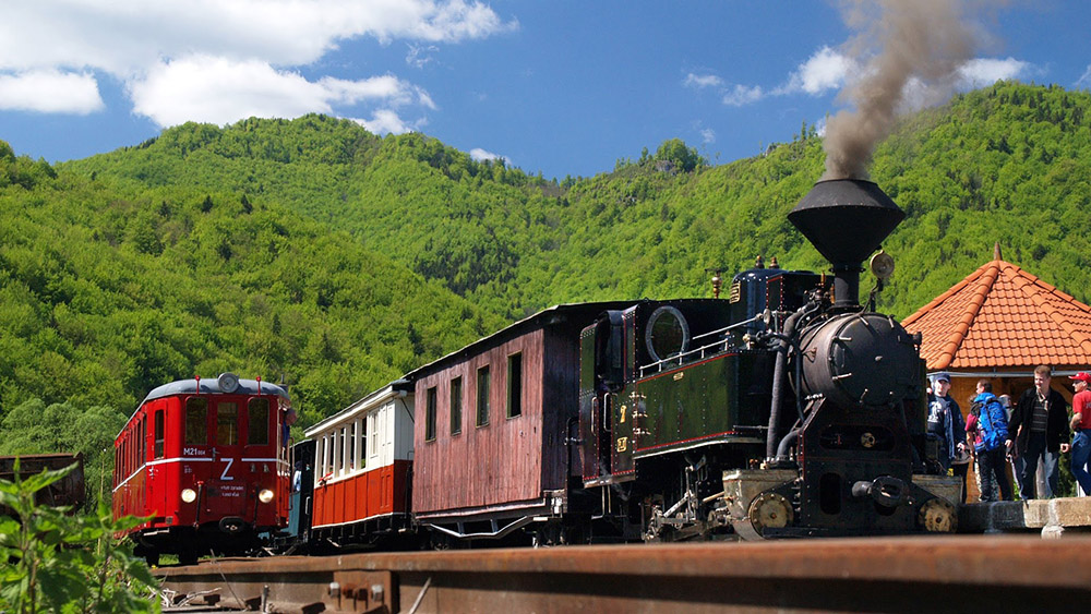
Čiernohronská Railway
A scenic ride across a charming rural landscape and beautiful nature in the historic wooden wagons of the forest railway accompanied by the whistling of the locomotive takes you back in time to places where wood was once carried down. In 2023, Čiernohronská Railway regularly services three routes every day during the main season from July 1, to September 3, 2023. All trains start and end their route in Čierny Balog – the outbound station of the Čiernohronská Railway. Each route takes you to places tightly connected with the history of the Čiernohronská Railway.
Routes:
- Čierny Balog – Šánske
- Čierny Balog – Vydrovo Forest open-air museum
- Čierny Balog – Dobroč
Vajskovská Valley
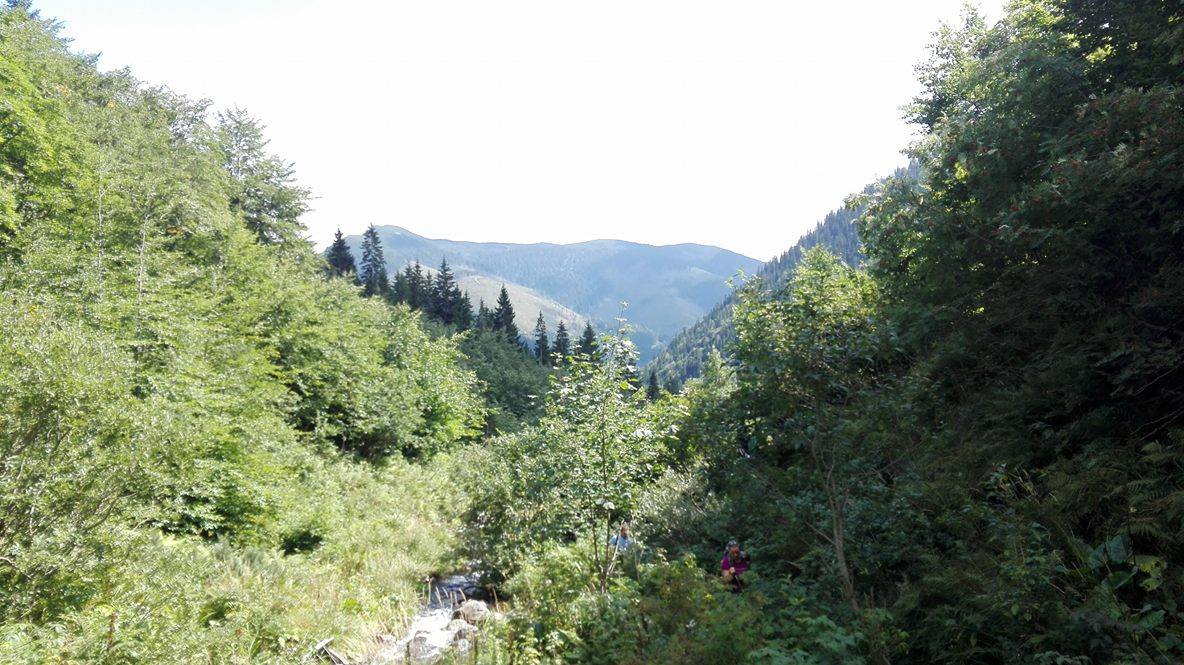
Vajskovská Valley is a valley located on the southern side of the Low Tatras. It is 9 kilometres long and spreads from the north to the south starting from the main ridge of the Ďumbier Tatras all the way to the Horehronie valley near gamekeeper’s lodge Črmné to the north of Dolná Lehota village into which cadastral area it belongs. The Vajskovská Valley starts under the Krížske saddle (1774m above sea level) in the area between Kotliská (1937mabove sea level) in the western direction and Poľana (1890m above sea level) in the north-eastern direction. It is one of the most beautiful valleys of the Low Tatras and it is a well-known silence zone. In order to protect nature, it is prohibited to make fires, to camp or to pick forest fruits in the valley. The first chamois brought from the High Tatras were released into the wilderness from this valley. It is part of NAPANT – the Low Tatras National Park and the upper part of the valley creates the eastern border with the Skalka National Nature Reserve.
The Vajskovský Creek runs through the valley and the Vajskovsky Waterfall is located in the upper part of the valley. The green hiking trail from Dolná Lehota to the Krížske saddle goes through the valley. Only one part of the trail up to the Vajskovský Waterfall is open to the public, the rest of it is closed in order to protect nature. There is also a marked cycle route 8599 in the valley and it ends at the Pálenica crossroads.